
Nature

Nunobiki Falls is considered to be one of 3 “Greatest Divine Falls” in Japan, and is historically significant in Japanese arts and literature. The falls is in 4 parts, and the very first is the upper half of the image, in an area called Ontaki. The second part of the falls, on the bottom half is called Mentaki.
[I learned that the bottom of the falls is even more gorgeous, and I guess I missed it last time. So… I need to go back…]
Nunobiki Falls is considered to be one of 3 “Greatest Divine Falls” in Japan, and is historically significant in Japanese arts and literature. The falls is in 4 parts, and the very first part starts here, in what this tiny fall and pond area called Ontaki.
[I learned that the bottom of the falls is even more gorgeous, and I guess I missed it last time. So… I need to go back…]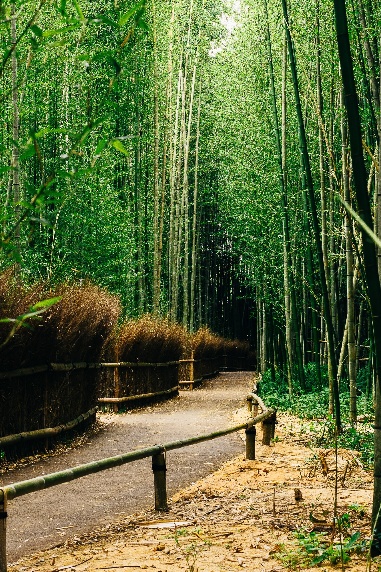
Almost everyone has heard about Kyoto’s Bamboo Forest, where luscious tall bamboo is everywhere and it is an absolutely gorgeous site to behold. But what you don’t know about the Bamboo Forest is how ridiculously small the area is. So take a small area, and pair it with seemingly everyone tourist in the world at once, and you get… an incredibly crowded space. I was 100% unable to get any good picture of the main area of the Bamboo Forest, but I never give up easily, and so I snuck around to a quiet area where I was gifted with this quiet scene.
The neat part is the bamboo is so thick, that even though the busy area is just right around the corner. You can’t hear the hustle and bustle.

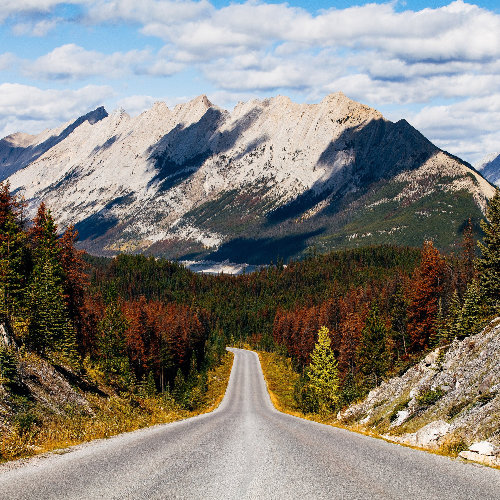
I love driving through the mountain roads. They twist, they turn, but the scenery as you go along is just breathtaking… If you’ve ever heard of the Icefield Parkway (Highway 93 officially) then you’d know that its considered one of the most beautiful roads in the world, and you can see why. When you’re heading south down this amazing road, at some point you’ll come across this view with a perfect view of Mount Christie. The little peak to the right of it is Brussels Peak, and the mountain in front to the farthest right is a part of Mount Fryatt, which is a pretty big chunk of rock.
Just remember, when you’re taking in this breathtaking view, you still need to watch the road!! Or just… stare at this print and avoid a collision in the safety and comfort of your home or office.

It’s not the fastest way to travel, but Highway A1, also known as Bow Valley Parkway is a detour worth taking. One of the most famous stops along the way is Morant’s Curve. Named after Nicholas Morant, a photographer who was hired by Canadian Pacific Rail to do promotional work for them. He photographed this spot so often that the area got named after him. And you can see why he was here so often. The view is just breathtaking, you have the bright blue of the Bow River and the various mountains surrounding Lake Louise (From left to right: Mount Temple, Mount Aberdeen, and Pope’s Peak). Add in the iconic CP Rail and you can easily see why Nicholas Morant spent so much time here.

She’ll be coming around the mountain when she comes… 🎶
I love driving through the mountain roads. They twist, they turn, but the scenery as you go along is just breathtaking… This was taken on the way back to Jasper from Maligne Lake, I rounded the corner and came to an abrupt stop. But I mean.. how could I not? Look at it! The mountain in the distance I THINK is Sirdar Mountain. I’ve tried to find information on it, but there’s really not a lot of info. They know it was named in the 1926 by someone named W.P. Hinton but no one knows who it’s named after… But I mean, it looks cool at least.
This image also comes in a both Portrait and Landscape variations.
(If you know what mountain that is in the distance, please let me know)

The Mistaya river leads into the Mistaya Canyon, which was of course carved out by the river. The waters run along the beautiful Highway 93, also known as the Icefields Parkway, and eventually ends up in the North Saskatchewan river, which means it comes to Edmonton!
Fun Fact: The name Mistaya also comes from the cree word ᒥᐢᑕᐦᐊᔭ (mistahaya) which means Grizzly Bear.

Sunwapta means ‘turbulent waters’ in Stoney, which is a very fitting name. Even shortly after exiting your vehicle, you can hear the rushing waters in the distance. As you walk towards the direction of the sound, it gets louder and louder until it’s pretty much the only thing you can hear. Sunwapta Falls is a fairly popular spot for tourists, partially due to it’s beauty but likely more so due to it’s ease of access. It’s so popular in fact that there’s a hotel literally right outside this waterfall so that people can stay near there and access trails and the falls with relative ease. With the Shackle Peak in the background, you can see why so many people love this waterfall.
Relive that feeling of rushing glacial water misting on your skin with this brilliant photo.

Medicine Lake is a relatively shallow lake, but it also isn’t really a lake at all, it’s more like a… reservoir of water for Maligne Lake and many others. Because of this, the water level changes fairly drastically through the year, with it being typically higher in the summer when the glaciers melt, and lower in the winter.
In the winter months, you can walk on many parts of the lakebed.

It was really calm. Taken in September right after the busy season had ended, the highway was quiet. The water was quiet. The only sound audible was the light breeze of the wind and the occasional splash by a duck or goose in the distance. There’s a beautiful blend of calm and drama when staring into the distance of Waterfowl Lake at sunset with Mount Patterson in the centre-right in the back, next to Breaker Mountain in the further right.
Mount Chephren is just one of many mountains situated along the Icefields Parkway. With a peak elevation of 10,850 feet or 3,307 meters, making it one of the taller peaks in the Waputik range of mountains. It’s named after Chephren, an Egyptian pharaoh. Originally it was named Pyramid Mountain in 1897, but of course there’s a Pyramid mountain in Jasper, so it was later changed in 1924 to it’s current name. At the base of Mount Chephren is the lovely Waterfowl lake, which gets it’s water from the Mistaya River.

One of my personal favourite photos. I was really only there for the sunset, but by pure chance I happened to catch a young kid wakeboarding a wave, with his friends looking and cheering him on. For me, that just screams youth. Going to the beach with your friends as the sun sets behind you in beautiful Hawaii. That’s just the ultimate youth experience in my opinion.

Moraine Lake is located just 14km away from the arguably more famous Lake Louise and draws in just as much tourism every year. The mountains help form the border between British Columbia and Alberta, and its famous cyan-coloured water is thanks to very fine particles of rock coming from the glaciers. Together they make this location one of the most stunning and beautiful locations in the world.
If you’ve been there before, you’ve undoubtedly taken some pictures while you were there. But now is your chance to relive the experience with a high quality, hi-resolution print of Moraine Lake.
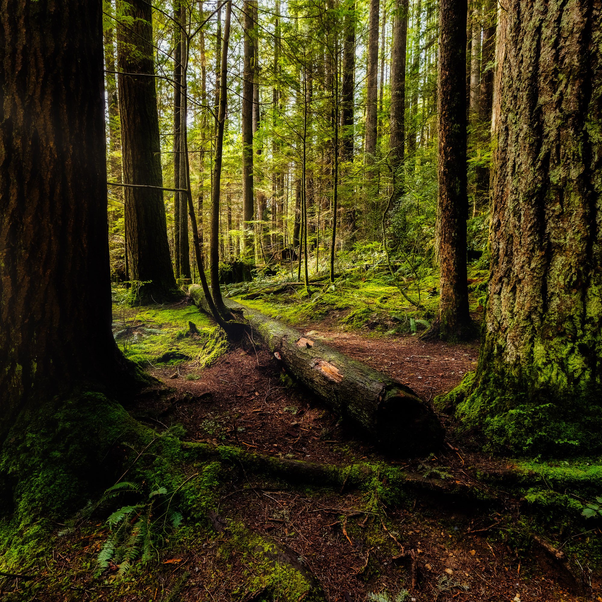
An early morning sunlight peeking through the trees at Lynn Canyon Park in North Vancouver.